[PREFACE]
[Image of page iii]
PREFACE.
As I was recommended to take a Long Vacation, and to have a thorough change of air, for the benefit of my health, I determined to make a voyage to the Antipodes, with the intention of returning home through the Pacific and via Panama. The latter part of my plan was never realized, as the subsequent pages show; and my only regret now is, that I was unable to make a visit to the Colony of South Australia (a place of especial interest to both the commercial and legal world at the Antipodes) fall in with my later plans. Its fame, from the luxuriance of its wheat and grapes, and from the inexhaustible wealth of its copper mines, is now equalled by the distinction it has acquired through its "Torrens' Land Act," by which a simple, inexpensive, and safe mode of conveying
[Image of page iv]
and transferring landed property has been devised. This Act has been found so useful in South Australia, that the Tasmanian, New South Wales, and Queensland Parliaments have now adopted it in their own Colonies. Its author, Mr. Torrens, is, I believe, in England, and perhaps may think fit to enlighten our public on this important subject.
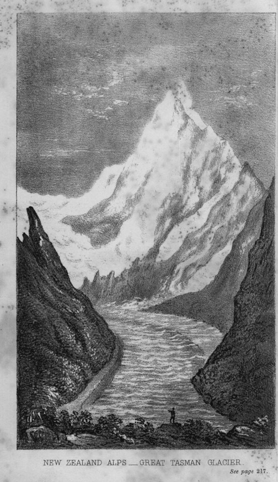
In the "Introductory Historical Sketch" I have connected eras in the Colonial History with remarkable European events; and throughout the subsequent chapters I have mentioned the expenses and charges at various places, in order to aid the reader in realizing the cost of living in the Colonies. From the foot notes it will be seen that I have frequently drawn information from previous writers; and I also take this opportunity of acknowledging the kind assistance afforded me in the Illustrations, Maps, and Statistics, by the following gentlemen:-- Sir C. Nicholson, Bart.; Messrs. Major (of the British Museum), Youl, G. Godwin (of the Builder), G. S. Walters, W. Hughes, F. R. G. S., and T. Saunders, F. R. G. S. For the views of the New Zealand glaciers I am indebted to the copies of sketches taken on the spot, published in the
[Image of page v]
"Australian Mail," a very well-conducted illustrated paper, printed at Melbourne.
The Map of Eastern Australia and New Zealand (which, for the convenience of my readers, is not bound into the book) has been copied from Messrs. Philip and Son's Tourist Series, and contains the latest discoveries.
March 13th, 1863.
POSTSCRIPT.
Through the kindness of Mr. Stanford, of Charing Cross, I have had the opportunity, since the following pages were sent to press, of reading Mr. Major's valuable works on Australian Discovery, (published by the Hakluyt Society,) from which I find that I have fallen into some slight inaccuracies, more especially in pages 2 and 3.
Fernandez de Quiros, though he discovered the New Hebrides (which he imagined to be part of the Southern Continent,) never saw Australia. One of his captains, however, Luis Vaez de Torres, either by design, or driven away by a storm, was separated from the rest of the squadron when lying off the New Hebrides, and, steering in a south-westerly direction, ran through the narrow straits since
[Image of page vi]
called Torres Straits. He noticed some land to the south of him, which was probably Cape York; and thus he had unconsciously seen the coast of Australia. By this voyage he proved that the New Hebrides were islands, but it remained for our own Captain Cook 1 to settle the question, whether New Guinea was connected or not with New Holland.
I omitted all mention of Eendraghtsland, on the west coast, which was discovered by a Dutch voyager in the ship Eendraght in 1616.
Cape Leeuwin (the Lioness) is so called from the name of the ship in which some unknown voyager doubled that point; and Carpentaria was most probably discovered by Tasman, and so named by him in honour of Carpenter, the then President of the Dutch East India Company.
Previously to reading Mr. Major's works, I had obtained my information from Harris's "Voyages" (2 vols, folio, 1744). They contain a fac-simile of Tasman's Chart, of which a carefully reduced copy has been made for this volume by Mr. Saunders, F. R. G. S. For the other ancient map I am indebted, through Mr. Major, to the Society of Antiquaries, who have been kind enough to allow me to copy it. The translation of the note on it is--"Nuca Antara was discovered in the year 1601 by Manoel Godinho
[Image of page vii]
de Eredia by command of the Viceroy Ayres de Saldanha;" and "Land discovered by the Dutch, which they called Eendraght, or Concord." Mr. Major has carried on most careful researches, in England, Holland, and Portugal; and as the result of his study he considers that this map is a copy of an older one which refers undoubtedly to Australia, and is the earliest which can be connected with the name of any known voyager. There are, however, six other older MS. maps, of which four are in England and two in France; but these are most probably copies of some original Portugese chart which has been lost, or cannot be easily found, and which may have given the general result of information gathered from several voyages shortly after the discoveries of Columbus, but cannot be connected with any one known voyage in particular. 2 It will be remembered that there existed then a deep feeling of jealousy between the Portugese and Spaniards on the point of maritime discovery, and for that reason the former would strictly conceal
[Image of page viii]
any information about the Australis Terra Incognita, which might have come into their possession, and consequently original documents may have have been lost, or so carefully hidden as not to be forthcoming now. After an interesting examination of of arguments on both sides of the question, Mr. Major arrives at the conclusion, that the Portugese were probably the first discoverers of Australia, in the early part of the sixteenth century, as stated in page 2 of my volume.
ERRATUM.
Page 189, line 4 from top, for "band of the Waitara" read "bank of the Waitara."